The Proposal
Background
In March 2019 Arun District Council identified our site as their preferred location for a new secondary school from the options short listed by West Sussex County Council (WSCC).
The need for a secondary school provides the opportunity to provide benefits for the whole community – promoting inclusivity, improving biodiversity and wellbeing.
The proposals include much needed housing to boost housing land supply and provision of affordable housing.
Location
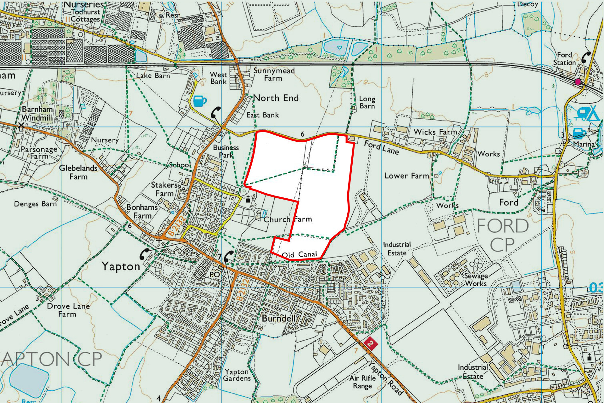
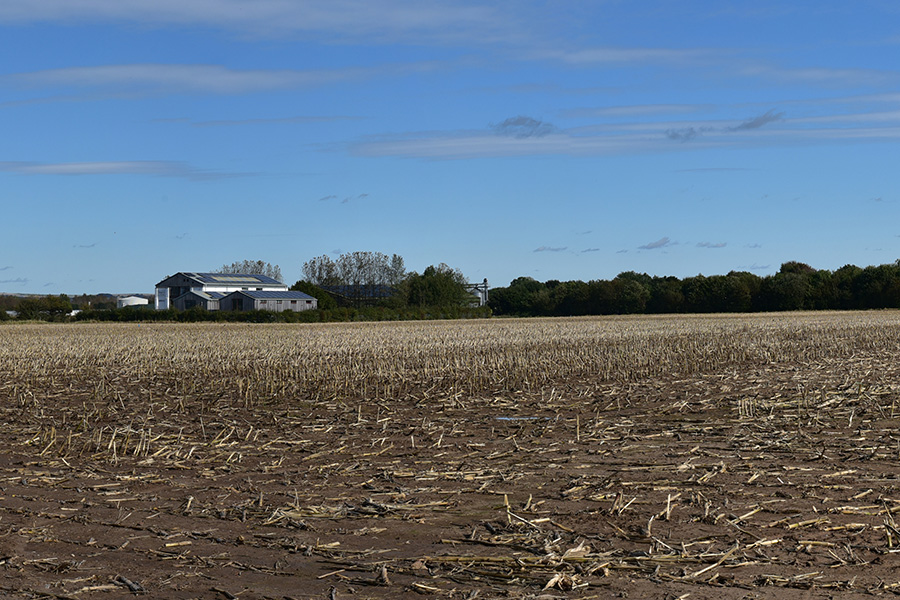
 Application Site (34.7ha)
Benefits
Our proposals will deliver a new secondary school alongside high quality housing, interwoven with social and environmental infrastructure that promotes inclusivity, biodiversity and wellbeing. This includes a Country park and other public open space / play space throughout the site.
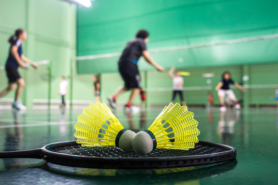
High quality sport & leisure facilities
A 10-form-entry secondary school
Country park
Up to 400 high-quality homes
30% affordable homes
New cycle/footpaths
Community space - ideas welcome
Masterplan
Our masterplan has the secondary school and playing fields at its heart, with a new country park to the west wrapping around the Conservation Area.
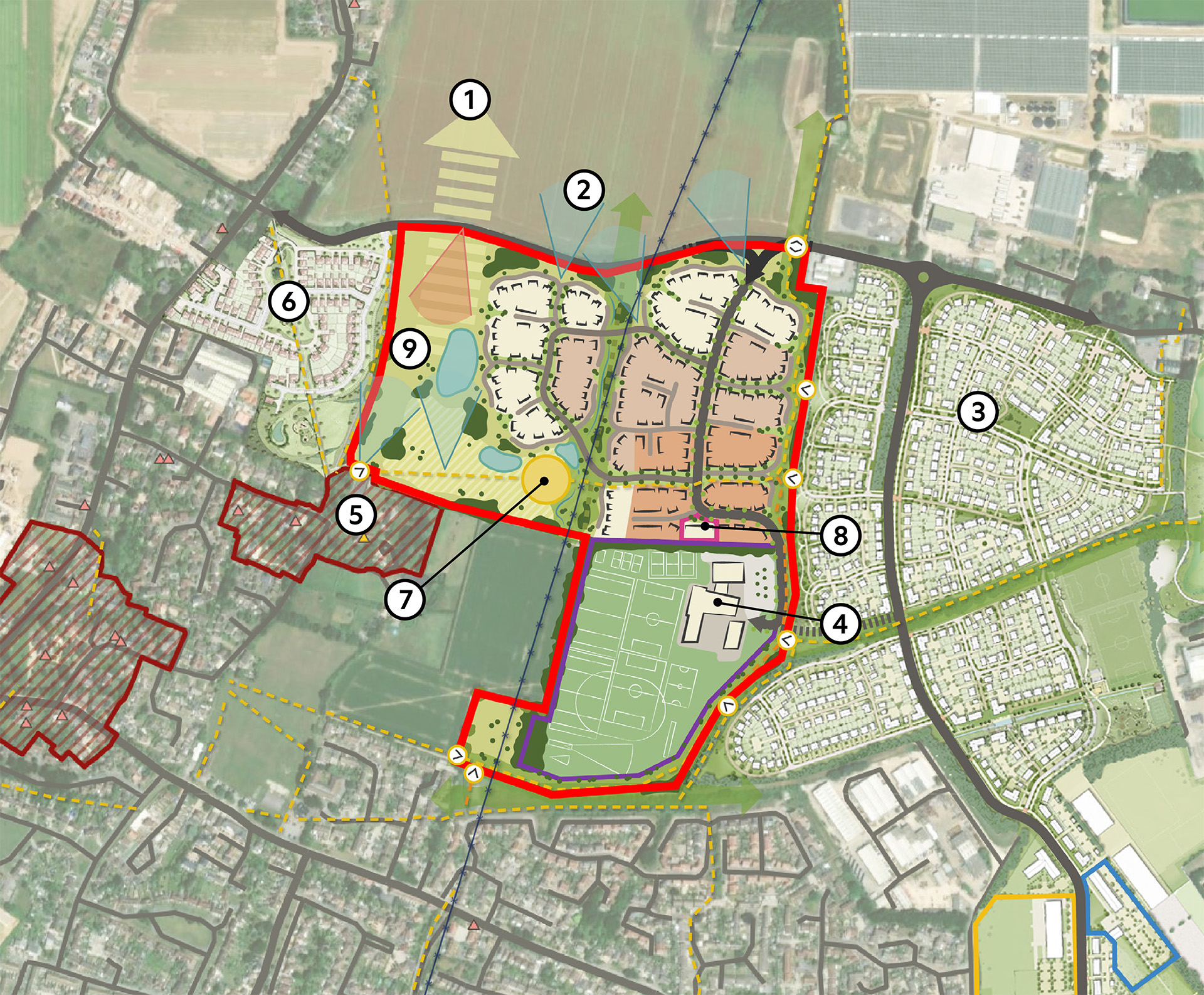
 Red Line Boundary (34.7ha)
 Rural landscape
 Views to South Down Nation Park
 The Landings
 Secondary school
 St Mary’s Church and Conservation area
 Meadow Gardens
 Amenity / Play
 Community space
 Country Park
Education
Central to our proposals is a 10-form entry secondary school which would serve the local area’s existing community as well as the growth in population, including the permitted new homes on The Landings. The school would be set in soft landscaping with a mix of ornamental and natural planting.
There have been a number of pre-application meetings and liaison with officers at Arun District Council and West Sussex County Council to arrive at the current masterplan. The need for a secondary school is denoted under Arun Local Plan Policy INF SP2.
The principal vehicular access would be off Ford Lane, with new cycleways and pedestrian links through the development and secure bike storage to promote safe active travel routes.
The school plans include new high-quality sports and leisure facilities, with a sports hall and a variety of pitches including a Multi-use games area (MUGA). These facilities would be shared with the wider community, promoting health and wellbeing for everyone. The school would be segregated from the sports and leisure facilities to enable wider public access outside school hours.


Housing
The development has been designed to be landscape-led and will include up to 400 high quality new homes, with 30% being affordable housing, all designed to be energy efficient, conserve water and reduce carbon. Their design will respect the local vernacular and materials and also promote the principles within the Arun Design Guide. The affordable homes will be indistinguishable and distributed across the housing area.
The existing mature trees and hedgerows will be complemented with new landscaping which help bed in and establish the new homes into the community. A variety of sizes of homes will be delivered, with the exact mix yet to be determined. There will be some terraced housing, mews courts, as well as detached and semi-detached homes to cater for individual occupancy and family homes.
Landscaping
We have taken a landscape-led approach to ensure that the development respects the conservation area and listed buildings within it (ie St Mary’s Church) but also the South Downs National Park to the north. The new country park on the western side of the proposed school and homes would create an attractive new community area of open space and enhanced with character forming native trees. Existing trees and hedgerows will be retained, enhanced with additional native planting.
In time the generous country park could create a continuous green link from Burndell Road through the King George V Playing Field, with connected green spaces as you travel northwards. To complement the new country park, there will be informal open spaces, new footways and new planting to provide greenways positive for people’s wellbeing, whilst also being valuable wildlife corridors. Attractive and comprehensive walking and cycling routes will be connected into the existing Public Right of Way network.
The sustainable drainage strategy will improve biodiversity by providing new habitats with drainage features attractively designed to look natural, integrated within the landscape.
Ecology
Ecological surveys have been undertaken. Our proposals will deliver a biodiversity net gain, increasing the variety of new habitats including new woodland, areas of meadow and creating an orchard.